|
|
|
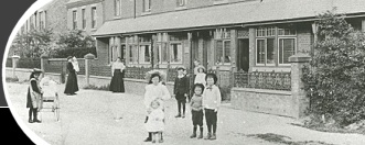
A farm at Quorn 300 years ago
by the Rev E Foord-Kelcey. Article written in 1908.
It is recommended that reference is made to the 3 pre-enclosure maps available on this website (search for "maps").
There lies before me a folded sheet of paper, once white but now of a slightly brown tinge. Folded it measures twelve inches long and eight wide. The writing on it is in a quaint character, that one could not have read without practice, and the ink is faded. Well might the paper bear signs of age for it has at the top left hand corner this date: June 14th 1602! It is headed:
"A tarrie delivered by Bartholomew Price of all the land laye and medow belonging to the new dwelling house of the said Bart. Price in Quarnedon."
The spelling throughout the document is very strange and uncertain. I shall generally correct it subsequent quotations.
Tarrie stands for terrier, that is a list or roll of land, and this terrier describes the land occupied by Bartholomew Price, who lived in a house at Quorn, then recently built. The house and land belonged Mrs Cave of Barrow, the widow of Henry Cave, who had died in 1600. She died in 1609. Her son Theophilus Cave had been born in 1584, and lived til 1656. The field, still called Cave's Close (where the cricket ground is) is named after this family.
In 1602, Price was tenant to Mrs Cave, for her son was not of age. Price's name occurs often in the Church Registers. He had eight daughters between 1597 and 1610, but apparently no sons. His own burial is entered under 1634.
I wish we could identify the house he lived in, if it is still standing. It is thus described in a paper dated 1605, attached to the Terrier (spelling unaltered):
" The house being by estimacion three baies having a Stable of one beaie and a barn of three baies with a convenient yearde belonging unto the same"
This, then, is the only description we have of the house and homestead and the terrier tells us of the land occupied with them making up what we now call a farm.
Our modern ideas lead us to picture his homestead with arable and meadow land lying round about it or near to it; but the real state of this farm was very different to this.
Before we go further I must remind you of the state of the land in the parish before the Inclosure in 1763 when nearly all the cultivated land in the parish lay open without hedges or ditches. There were three great divisions. The North or More Field, the West Field and the South Field. The arable part in these great Fields was divided up into shots or furlongs varying much in size as the fields of the present day do. And these shots or furlongs were divided into narrow strips like allotment gardens. The narrowest ones were meant to contain a rood (or quarter acre), and broader ones a half acre. Once person might own or farm one strip and have different persons as owners or cultivators of the strips on each side. These strips were called "lands"
The diagram shows some ground near the Woodhouse Road set out as it used to be in furlongs and lands.
The pasture ground was made up of little portions much in the same way. First there were leas (spelt sometimes leys, lays, laies or lease), which were small separate pieces of grass land generally in marshy places.
Secondly, there were large pieces of grass land called meadows in the low lying parts of the parish, which were divided into strips for mowing, but thrown open for the beasts of all the different owners after hay-time.
It seems very difficult to believe that farming could be carried on under such a system, but it certainly was, and the Terrier before gives us an actual instance. We shall see that Price's farm was made up of forty disconnected pieces of arable and pasture land scattered about the parish. These forty pieces only made up 16 acres altogether.
We will take a few items from the list to show how the scattered portions were described. Here is the first (spelling altered) which is shown:
"In the More Field Land
One half acre beneath the Windmill shooting into Barrow Highway at the south end and upon John Swan's headland for Mr Humphrey Farnham free at the north end and Thos. Staples for Beaumanor on the east and west sides"
'More Field' is another name for North Field because of the damp swampy moor that lay by the present osier beds. 'The Windmill' in this part of the parish has of course long disappeared. Perhaps it was set up to pump water out of the moor and thus drain the surrounding land. 'Shooting into' means that the strip of land extended towards the Barrow road. 'Headland' means a strip which ran across the end of the other strips (see diagram). This was cultivated by another person, in this case John Swan who was tenant for Mr H Farnham. 'Free' means that it was freehold.
Humphrey Farnham of the Over Hall, born 1558, died 1620; Adrian Farnham (referred to below) of the Nether Hall, born 1568, died 1632.
Here is another land:
"One half acre upon Nether Stone croft shooting into Loughborough Highway hard by Higin's Pit at the W. end. John Mesome for Mrs Cave on the S. side. Mr H Farnham free on the N side"
The 'Nether Stonecroft' was a furlong by the present road leading to Mr Moss's Farm. This land ran up to the highway. I don't suppose we can find Higins's pit now though I have found another pit elsewhere mentioned in this very Terrier.
John Mesome held a very similar farm to Price's also belonging to Mrs Cave of Barrow.
Now we will take in an item in the West Field because in it is mention the pit just alluded to:
"One half acre shooting into Lambkin Pit at W. end upon Henry Martin's headland for Staples free at E. End. Mr Adrian Farnham at S side. Mr Middleton for Mr A Farnham on N side."
This Lambkin Pit I have discovered for certain in the field now used by Mr Bamber opposite to his house and so we know within a little where this half acre lay. This half-acre would be one of those strips on the diagram going from the road to the Pit.
Here is another which would be just about where the GCR Station now stands. Rigsty or Ridgestie as it is here spelt stands for that part of the parish beyond Chaveney Road to the Woodhouse boundary. This was quite a small land
"One rood hither side of Rigsty Pit shooting into Woodhouse highway at W end. J Mesome for Mrs Cave on E Side. Mr A Farnham on W side."
I have looked for the Rigsty Pit in vain. I am afraid it has been obliterated by the making of the railway and station.
The last extract shall be from the South Field that is the part of the parish between the Village and Mountsorrel. This is a lea or laye ie a piece of pasture.
"One half acre laye shooting upon Thomas Munk's headland at N end. Adrian Stables for Mr A Farnham, West; and Robert Hood of Mountsorrel on E side"
I believe that T Munk was a Mountsorrel man, where the name is still to be found. The lea was near Mountsorrel and men of that village naturally held land in the neighbourhood.
Adrian Staples was one of a family that farmed land under the Farnham's for generations.
In the four items quoted we have shown that our farmer had pieces of land about the parish widely separated from one another. From the Terrier we see he also had land right away near the furthest N corner of this parish 1 and a half miles from the village, also away over by the Woodthorpe border beyond "One Ash" gate, and the last item of all is a tiny piece, half a rood, "one hempe land lying by the Church wall"
Now let us try to realize the difficulties that our old-time parishioner Price had to face in his farming operations. His house, stable, barn and yard, ie his homestead was certainly in the village (I fancy down Meeting Street) but his land consisted of 40 pieces scattered about the parish , in every direction, some of it a mile and a half away. One would think he would hardly recollect where all his pieces lay and what was wanting to be done in each. The methods of cultivation were necessarily different in those days.
As stated earlier Bartholomew Price finished with this life's labours and perplexities 32 years after the date of this Terrier. The day came when he would no more tramp down to the Moor field to see how his sheep were doing in the meadows and leas or guide his plough round and round his little strips on the breezy Rigsty. The busy life about his house and home stead was for the time hushed, for another man gone to his long home. A few days later the body of Bartholomew was borne by his 'Convenient yearde' to the Church he was named after and his bones perhaps might still be found not far from the little 'hempe land' he tilled lying by the Church wall. They buried him on April 19th 1634, in the Spring time when the crops were sprouting and pastures beginning to freshen after the winter's sleep. Let us hope that old Bartholomew's thoughts went sometimes beyond his crops and flocks and that he also went to rest in good hope of the spring-time and summer of faithful souls.


| |
|
|
 |
Submitted on: |
2009-08-26 |
|
Submitted by: |
Kathryn Paterson |
|
Artefact ID: |
512 |
|
Artefact URL: |
www.quornmuseum.com/display.php?id=512 |
 |
Print: |
View artefact in printer-friendly page or just on its own (new browser tab). |
|
|
|
|
|